Browse Items (993 total)
  • Collection: Chester Smolski Photographs
http://www.ricdigitalcommons.com/temp/0556.jpg
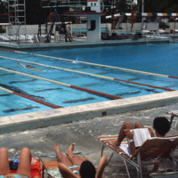
The pool at the university of Miami, Croal Gables campus. The campus is located just south of the city of Miami and was chartered in 1925. This photograph dates from the late 1970s.

http://www.ricdigitalcommons.com/temp/0557.jpg
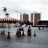
The University of Miami main campus is Coral Gables, just south of the city of Miami. This photograph was taken in 1978 and looks south across the food court, with resident halls on the horizon. The school was chartered in 1925 and currently enrolls…

http://www.ricdigitalcommons.com/temp/0558.jpg
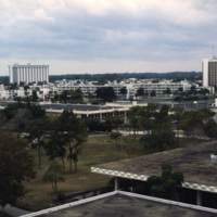
The University of Miami Coral Gables campus, just south of Miami. This landscape view shows the University Communications building on the left and freshman housing on the right.

http://www.ricdigitalcommons.com/temp/0560.jpg
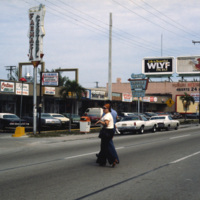
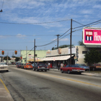
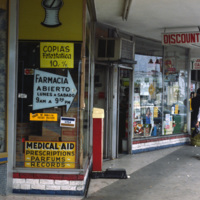
This photograph shows Cuban influence in Miami, specifically here on SW 8th St., part of Little Havana. The nickname comes from the large Cuban population from the 1970s through the 1990s following an influx of Cuban refugee’s and the creation of a…

http://www.ricdigitalcommons.com/temp/0561.jpg
This photograph shows Cuban influence in Miami, specifically here on SW 8th St., part of Little Havana. The nickname comes from the large Cuban population concentrated in the area from the 1970s through the 1990s. The influx of Cubans in the area,…

http://www.ricdigitalcommons.com/temp/0562.jpg
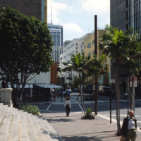
An east facing view down East Flagler St. in Downtown Miami. The street is named for nineteenth century railroad magnate Henry Flagler, and it runs west across town to the Florida Turnpike. This photograph show’s two buildings that have become…

http://www.ricdigitalcommons.com/temp/0563.jpg
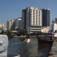
An image taken from the Miami River Walk looking northeat shows One Biscayne Tower as the tallest building in the city, which it was until 1984. It has since been eclipsed by modern building standards but remains a symbol of the city. The building…

http://www.ricdigitalcommons.com/temp/0564.jpg
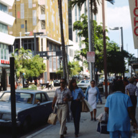
This photograph is taken at the intersection of Flagler St. and NE 1st Ave. Downtown Miami is both an urban residential neighborhood and the central business district. This specific neighborhood is known as the Jewelry District, so named for it’s…

http://www.ricdigitalcommons.com/temp/0565.jpg
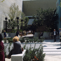
Chet Smolski photographed this as an example of a vest pocket park in Miami. Also known as mini parks, or parketts, these small urban parks are placed on vacant lots between buildings are accessible to the general public.

http://www.ricdigitalcommons.com/temp/0566.jpg
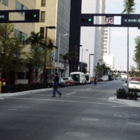
This street scene photograph was taken at the intersection of Miami Ave. and Flagler St. Smolski points out in his notes that he was interested here in the traffic light design, which is unique to the city, and are still in use today.

http://www.ricdigitalcommons.com/temp/0567.jpg
During the 1960s and 1970s large numbers of Cuban immigrants moved into Miami, many of whom settled in a neighborhood of Miami that came to be known as Little Havana. This photograph from Downtown Miami is Smolski’s illustration of the Cuban…

http://www.ricdigitalcommons.com/temp/0568.jpg
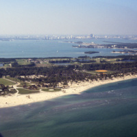
This west facing aerial photograph shows Key Biscayne and, on the horizon, Downtown Miami. Seen here on Key Biscayne is Crandon Park and Crandon Park Golf Course. Crandon Beach was formally a zoo, but is now a park where creatures like turtles,…

http://www.ricdigitalcommons.com/temp/0569.jpg
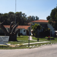
Virginia Gardens is a Village in Dade County that broke away from neighboring town Miami Springs in 1947 after a disagreement over a ban on horses. This 1978 photograph shows the town hall and community center of Virginia Gardens. The village takes…

http://www.ricdigitalcommons.com/temp/0570.jpg
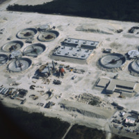
The South District Wastewater Treatment Plant is located just south of Miami. This aerial photograph was taken in 1978 shows the plant in its early stages of construction. Today, plans are underway to reclaim the water that comes out of the plant in…

http://www.ricdigitalcommons.com/temp/0571.jpg
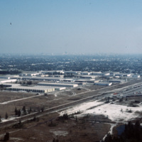
This industrial park in Miami is likely located on the western outskirts of town, where most of Miami’s warehouses and stone quarrying industries are located, extending into neighboring suburbs Doral and Hialeah.

http://www.ricdigitalcommons.com/temp/0573.jpg
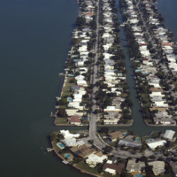
Biscayne Point in Miami Beach is a residential neighborhood made up of three man made islands in Biscayne Bay. The Biscayne Point islands are a part of the North Beach, which is the are north of 63rd Ave and Collins. This aerial photograph looks down…

http://www.ricdigitalcommons.com/temp/0574.jpg
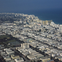
This aerial view shows most of Miami Beach’s South Beach neighborhood, including the famous Collins Avenue hotels. Also visible is the Miami Beach Golf Club, the Miami Beach Convention Center and many of the apartment style residents in South Beach.…

http://www.ricdigitalcommons.com/temp/0575.jpg
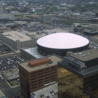
This is an aerial shot of Market Square Arena in Indianapolis, Indiana in the early 1990s. The arena was completed in 1974, closed in 1999, and demolished in 2001. It was Indiana's primary concert venue until its demolition, hosting acts such as…

http://www.ricdigitalcommons.com/temp/0576.jpg
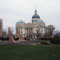
The Indiana State House is the fourth structure to house the Indiana government, and has been the current State House since 1887, a year before the buildings formal completion. Designed by Edwin May in 1878, the building utilizes an extended Greek…

http://www.ricdigitalcommons.com/temp/0577.jpg
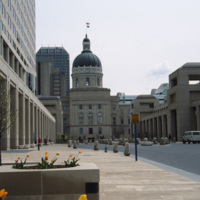
Viewed from the south side, this photograph of Indiana’s State House shows the Italian Renaissance style dome and Neoclassical facade that makes this building one of the finest example of Neoclassical architecture in the state. The building was…

http://www.ricdigitalcommons.com/temp/0578.jpg
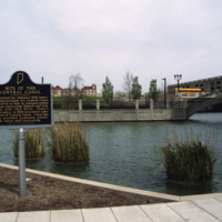
This photograph shows the site of the Central Canal, a proposed 296 mile canal that was to connect Peru to Evansville where it would then meet the Ohio River.The canal was aborted after the state fell into bankruptcy in 1939. This 1993 photograph…

http://www.ricdigitalcommons.com/temp/0579.jpg
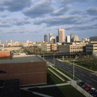
The Indianapolis skyline as seen from Indiana University - Purdue University Indianapolis. The campus serves both universities as an urban campus in Indianapolis. This photo was likely taken from University Place Hotel and shows the IUPUI conference…

http://www.ricdigitalcommons.com/temp/0580.jpg
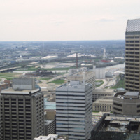
This photograph is believed to be taken from the Chase Tower. Completed in 1990, the Chase Tower (at the time known as the Bank One Tower), at 830 feet, surpassed the One America Tower (pictured, left) as the tallest building in the state. The One…

http://www.ricdigitalcommons.com/temp/0581.jpg
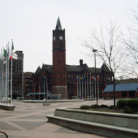
Thomas Rodd’s design of Indianapolis Union Station shows influence of noted architect Henry Hobson Richardson. Also shown here is the Pan American Plaza, built in 1987 to commemorate the Pan American Games held in town. The Union Station still serves…

http://www.ricdigitalcommons.com/temp/0582.jpg
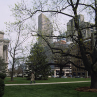
Photographed from the lawn of the Indian State Capitol is the One America Building, the state’s tallest building from 1982 to 1990 when it was surpassed by the Chase Tower. At the left of the photograph is an example of the Neoclassical facade of the…

http://www.ricdigitalcommons.com/temp/0583.jpg
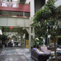
Interior photograph of the Crowne Plaza Hotel at Indianapolis Union Station. The hotel is located in the train shed which was completed in 1915. Following World War II the station saw rapidly declining numbers in passanger service fell increasing to…

http://www.ricdigitalcommons.com/temp/0584.jpg
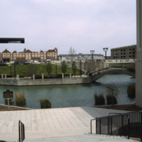
Indianapolis’ White River State Park was built around the site of the Central Canal, a failed canal venture from the early nineteenth century. Since the restoration in the 1980s, the park has become the cultural center of the city and is considered…

http://www.ricdigitalcommons.com/temp/0585.jpg
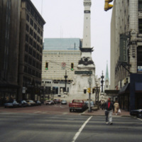
The Soldiers’ and Sailors’ monument was designed by Bruno Schmitz, a German architect, for the city of Indianapolis. The building houses a basement Civil War Museum. There is an observation deck at the top that can be reached by climbing 330 stairs,…

http://www.ricdigitalcommons.com/temp/0586.jpg
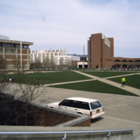
This photograph shows the integration of Indiana University-Purdue University Indianapolis campus with the University Place Hotel in downtown Indianapolis. Cavanaugh Hall, at frame left, is home of Indiana University’s School of Liberal Arts. Between…

http://www.ricdigitalcommons.com/temp/0587.jpg
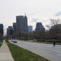
This east facing view down W New York St. shows the Indianapolis’ skyline rising up from the flat midwestern landscape. The state’s two tallest buildings, the Chase Tower and the One America Tower are pictured in the center.

http://www.ricdigitalcommons.com/temp/0588.jpg
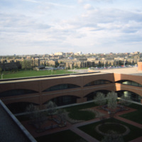
Indiana Avenue Apartments photographed from University Place Hotel at IUPUI campus in Indianapolis. The Indiana Avenue Apartments are public housing managed by the Indianapolis Housing Agency (IHA).

http://www.ricdigitalcommons.com/temp/0590.jpg
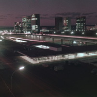
Looking west down Brasilia’s Monumental Axis Smolski capture’s an array of modernist architecture. Of note, to the left is Correios, the national headquarters for Brazil’s postal service. Prominent in the center right of the photograph is Brasilia’s…

http://www.ricdigitalcommons.com/temp/0591.jpg
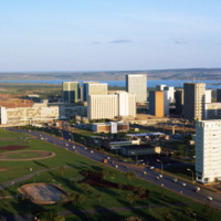
This south facing view of Brasilia looks across the ‘wings’ of the city into the planned residential neighborhoods. The modernist architecture, designed by Oscar Niemeyer, dominates the city. In the foreground of the photograph is a subway station…

http://www.ricdigitalcommons.com/temp/0592.jpg
This photograph faces south east across Brasilia’s Monumental Access. The photograph was taken from the TV Tower. Prominent in the left middle ground is the Praça dos Aposentados, a housing complex for retired persons. Just behind that is the…

http://www.ricdigitalcommons.com/temp/0594.jpg
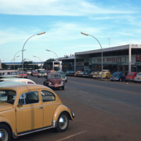
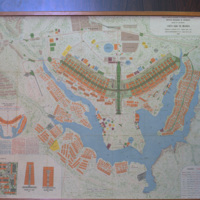
Brasilia is a planned city that has been both criticized as a failed utopia acclaimed as a masterpiece of modernist architecture. The city is mapped out into sections forming the shape of a bird or airplane. This photograph is taken in one of…

http://www.ricdigitalcommons.com/temp/0596.jpg
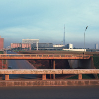
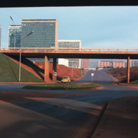
This photograph looks west on Brasilia’s Monumental Axis under the overpasses of the North and South Roads, where the bus and subway terminals are located. Smolski notes on the slide the choice to install roundabouts rather than traffic signals.

http://www.ricdigitalcommons.com/temp/0599.jpg
Designed by Oscar Niemeyer, the National Congress Building is a masterpiece among the many of his works in the Brazilian modernist style. This unique layout separates the Senate and the Chamber of Deputies into two separate semi-speherical…

http://www.ricdigitalcommons.com/temp/0603.jpg
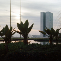
From the Catedral de Brasilia, this photograph looks west toward the National Congress Building. In the foreground is one of the statues, distinctly modernist that line the entry to the Catedral. Both the Catedral de Brasilia and the National…

http://www.ricdigitalcommons.com/temp/0604.jpg
This 1969 map of Brasilia show’s the bird-like shape of the city as designed by Lucia Costa. He was hired by President Juscelino Kubitschek to design the city in what had previously been a waste land with scarce water, animals, plants or people.

http://www.ricdigitalcommons.com/temp/0605.jpg
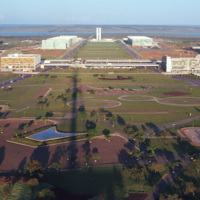
This east facing view of Brasilia was photographed from the TV Tower. This photograph illustrates the layout of the city, which was planned in the shape of a bird. At the center of the photograph is the National Congress Building, with it’s twin…

http://www.ricdigitalcommons.com/temp/0606.jpg
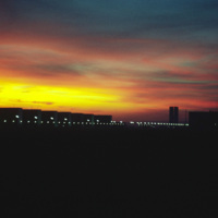
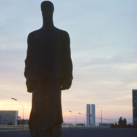
The silhouettes of Oscar Niemeyer’s public architecture create the horizon of this Brasilia sunset photographed by Chet Smolski in 1974. Niemeyer’s distinctly shaped buildings are a symbol of Brasilia. Note the top of the Catedral de Brasilia…

http://www.ricdigitalcommons.com/temp/0609.jpg
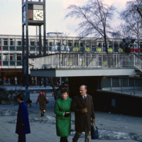
Town center in Stevenage photographed in 1969. Opened in 1959, this business area has at it’s focal point the clock tower, made well known by the 1967 British comedy “Here We Go Round the Mulberry Bush” and dedicated in memorial to Lewis Silkin,…

http://www.ricdigitalcommons.com/temp/0612.jpg
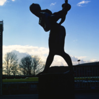
This bronze statue, entitled “Joyride” was made by Franta Belsky, who moved to England from Czechloslavakia in 1938. The modern statue, a mother playfully carrying her child, was unveiled in 1958 in the Stevenage Town Square. Stevenage is one of…

http://www.ricdigitalcommons.com/temp/0613.jpg
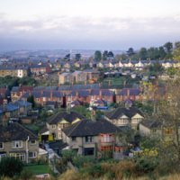
This photograph shows the town of Swindon in Wiltshire county. Since being named an Expander Town in 1952, Swindon has experienced significant growth, and the density of the residential neighborhoods is illustrated here. Smolski acknowledges this,…

http://www.ricdigitalcommons.com/temp/0615.jpg
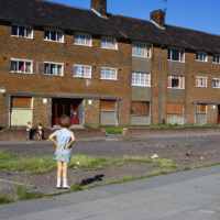
This image shows low-income housing in Kirkby, a town in the Metropolitan county Merseyside. This slide is labeled as ‘slum housing’. Kirkby, which was once largely farmland, experienced massive growth following the destruction in Liverpool during…

http://www.ricdigitalcommons.com/temp/0617.jpg
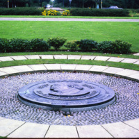
This memorial to Sir Ebeneezer Howard sits within Welwyn Garden City, founded in 1920. Howard’s 1898 publication, Garden Cities of To-morrow, lead to the development of garden cities in which people live harmoniously with nature. Welwyn Garden City…

http://www.ricdigitalcommons.com/temp/0618.jpg
Letchworth was one of the first of England’s “new towns,” and Sir Ebeneezer Howard’s first Garden City. While living in the United States, Howard was influenced by the poet Walt Whitman, among others, to tackle the problems of urban life. His idea…

http://www.ricdigitalcommons.com/temp/0622.jpg
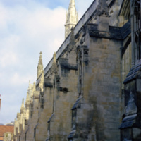
Winchester Cathedral is one of the largest cathedrals in England. This image shows the massive buttresses that support this stone cathedral. Winchester Cathedral, known for being the longest of the medieval cathedrals in Britian, is also a popular…

http://www.ricdigitalcommons.com/temp/0623.jpg
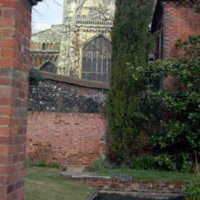
The eastern end of Winchester Cathedral photographed from a garden off of Colebrook St. The Winchester Cathedral has the longest nave of all the medieval cathedrals in England. This view show’s the cathedral’s gothic style architecture. While the…

http://www.ricdigitalcommons.com/temp/0624.jpg
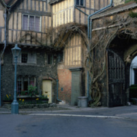
The Porter’s Lodge and Cheyney’s court at Winchester Cathedral, both 15th century constructions, are wonderful examples of half-timber architecture. Cheyney Court was the home of the Bishop’s court in the medieval days. Presently it is the home for…
Output Formats

atom, dcmes-xml, json, omeka-xml, rss2