Browse Items (13 total)

  • Tags: Miami

http://www.ricdigitalcommons.com/temp/0571.jpg
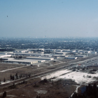
This industrial park in Miami is likely located on the western outskirts of town, where most of Miami’s warehouses and stone quarrying industries are located, extending into neighboring suburbs Doral and Hialeah.

http://www.ricdigitalcommons.com/temp/0570.jpg
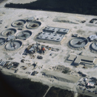
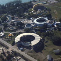
The South District Wastewater Treatment Plant is located just south of Miami. This aerial photograph was taken in 1978 shows the plant in its early stages of construction. Today, plans are underway to reclaim the water that comes out of the plant in…

http://www.ricdigitalcommons.com/temp/0567.jpg
During the 1960s and 1970s large numbers of Cuban immigrants moved into Miami, many of whom settled in a neighborhood of Miami that came to be known as Little Havana. This photograph from Downtown Miami is Smolski’s illustration of the Cuban…

http://www.ricdigitalcommons.com/temp/0566.jpg
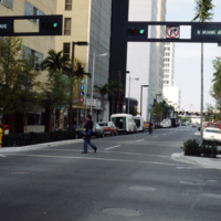
This street scene photograph was taken at the intersection of Miami Ave. and Flagler St. Smolski points out in his notes that he was interested here in the traffic light design, which is unique to the city, and are still in use today.

http://www.ricdigitalcommons.com/temp/0565.jpg
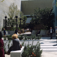
Chet Smolski photographed this as an example of a vest pocket park in Miami. Also known as mini parks, or parketts, these small urban parks are placed on vacant lots between buildings are accessible to the general public.

http://www.ricdigitalcommons.com/temp/0564.jpg
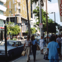
This photograph is taken at the intersection of Flagler St. and NE 1st Ave. Downtown Miami is both an urban residential neighborhood and the central business district. This specific neighborhood is known as the Jewelry District, so named for it’s…

http://www.ricdigitalcommons.com/temp/0563.jpg
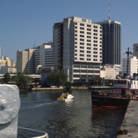
An image taken from the Miami River Walk looking northeat shows One Biscayne Tower as the tallest building in the city, which it was until 1984. It has since been eclipsed by modern building standards but remains a symbol of the city. The building…

http://www.ricdigitalcommons.com/temp/0562.jpg
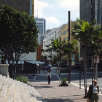
An east facing view down East Flagler St. in Downtown Miami. The street is named for nineteenth century railroad magnate Henry Flagler, and it runs west across town to the Florida Turnpike. This photograph show’s two buildings that have become…

http://www.ricdigitalcommons.com/temp/0561.jpg
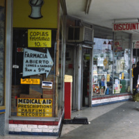
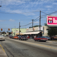
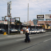
This photograph shows Cuban influence in Miami, specifically here on SW 8th St., part of Little Havana. The nickname comes from the large Cuban population concentrated in the area from the 1970s through the 1990s. The influx of Cubans in the area,…

http://www.ricdigitalcommons.com/temp/0560.jpg
This photograph shows Cuban influence in Miami, specifically here on SW 8th St., part of Little Havana. The nickname comes from the large Cuban population from the 1970s through the 1990s following an influx of Cuban refugee’s and the creation of a…

http://www.ricdigitalcommons.com/temp/0551.jpg
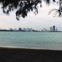
The Miami skyline as seen from Key Biscayne in 1978. At the right are some of Miami’s most famous skyscrappers, including th SunTrust International Center, completed in 1973, and One Biscayne Tower, a symbol of the city, completed in 1972. At the…

http://www.ricdigitalcommons.com/temp/0550.jpg
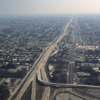
This aerial photograph looks south down Interstate 95 in Miami. In the foreground is the Golden Glades Interchange Extended. Interstate 95 is the longest running north-south route in the highway system, running from the Canadian border in Maine to…

http://www.ricdigitalcommons.com/temp/0549.jpg
The Miami Seaquarium is an oceanquarium. It is located in Biscayne Bay. Completed in 1955, the Miami Seaquarium was South Florida’s first Marinelife attraction. The Miami Seaquarium is primarily a tourist destination, famous for it’s opportunities to…
Output Formats

atom, dcmes-xml, json, omeka-xml, rss2