Browse Items (1954 total)

http://www.ricdigitalcommons.com/Baxter_temp/CV-81-002.jpg
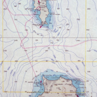
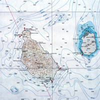
An enlarged view of a map of Cape Verde showing the islands Sal and Boavista.

http://www.ricdigitalcommons.com/Baxter_temp/CV-81-370.jpg
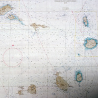
A contour map of the Cape Verde archipelago.

http://www.ricdigitalcommons.com/Baxter_temp/CV-81-308.jpg
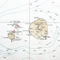
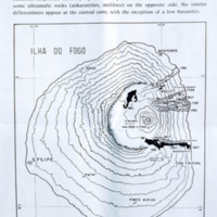
Contour map of the island, Fogo. The island, located in the Cape Verde archipelago, is mostly a large volcano, Pico do Fogo. It is laregly dormant, but has had intermittent eruptions, the last of which occurring in 1995.

http://www.ricdigitalcommons.com/Baxter_temp/CV-81-260.jpg
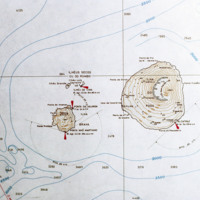
A contour map of the islands Fogo and Brava, a detail from a larger map showing the entire Cape Verde archipelago. Note the contour of Fogo, which contains Pico do Fogo, the highest point in Cape Verde, and active volcano.

http://www.ricdigitalcommons.com/temp/5184.jpg
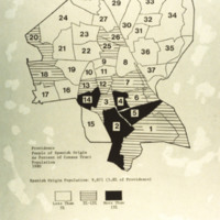
A map of the percentage of people with Spanish origin in Providence in 1980. Spanish origin population: 9,071 (5.8% of Providence). Key: in white areas less than 5% of people are of Spanish origin; horizontal lines are areas with 5%-15% Spanish…

http://www.ricdigitalcommons.com/Baxter_temp/CV-81-367.jpg
Detail of a contour map showing the islands Santiago and Maio.

Tags:

http://www.ricdigitalcommons.com/Baxter_temp/CV-81-008.jpg
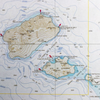
Detail from a topographical map of Cape Verde (see CV-81-001). This detail shows the islands São Antão, São Luzia and São Vicente.

http://www.ricdigitalcommons.com/Baxter_temp/CV-81-178.jpg
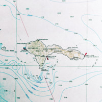
Detail from a map of Cape Verde showing São Nicolau. The island is in the northwest section of the Cape Verde archipelago and is in the windward group known as Barlavento. This map detail is from a larger map published in 1970.

http://www.ricdigitalcommons.com/Baxter_temp/CV-81-287a.jpg
This map illustrates the history of volcanic eruptions on the island of Fogo. "On the western slope of the island there are differentiated types passing into basanites (nepheline basalts), tephrites, and phonolites, on the salic side, and into some…

Tags: , ,

http://www.ricdigitalcommons.com/temp/5307.jpg
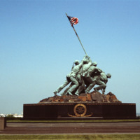
  The Marine Corps War Memorial stands as a symbol of this grateful Nation's esteem for the honored dead of the U.S. Marine Corps. While the statue depicts one of the most famous incidents of World War II, the memorial is dedicated to all Marines who…

http://www.ricdigitalcommons.com/Baxter_temp/CV-81-267.jpg
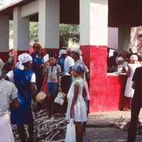
A busy market scene in São Felipe, the main city on Fogo. Although the island is home to a large and active volcano, and also because of it, it is a well populated island due to the high fertility of the soil. São Felipe is known for it's pastel…

http://www.ricdigitalcommons.com/temp/1057.jpg
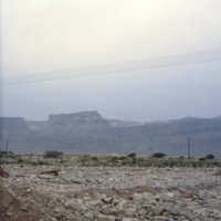
Masada is a natural fortress which was used by Jews during rebellion against the Romans. It is located near the Dead Sea and some biblical fragments, pieces of the Dead Sea Scrolls, have been located here. In AD 73/74 nine hundred Jewish rebels…

http://www.ricdigitalcommons.com/temp/1058.jpg
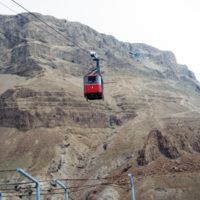
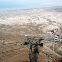
Masada, once a fortress in the last Jewish holdout against the Romans, represents bravery and self sacrifice to modern Jews, which ended in the mass suicide of nine hundred rebels. It is now reached by cable car for visitors. In the twentieth…

http://www.ricdigitalcommons.com/temp/1063.jpg
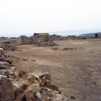
This photo is taken at the top of Masada, a horst that was used as a fortress by many ancient people. King Herod, in the first century BC, built an elaborate palace here, perhaps fearing he would have to go into isolation because of his unpopularity…

http://www.ricdigitalcommons.com/temp/1072.jpg
Largely untouched for two thousand years, this photograph shows the original Roman access road to Masada, which can still be traveled on foot by visitors. On the western side, this “ramp” was constructed by the Romans as a way to penetrate the…

http://www.ricdigitalcommons.com/temp/1061.jpg
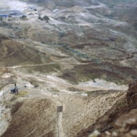
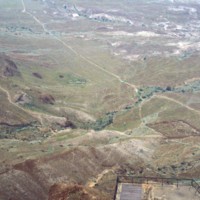
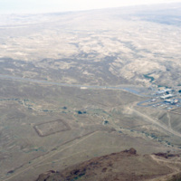
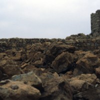
Seen from atop Masada, a natural fortress in an otherwise wasteland, is the remains of a Roman Siege camp from AD 74. Jewish rebels took the fortress in AD 66 and held it for seven years until Romans took them by force. The rebels committed mass…

http://www.ricdigitalcommons.com/temp/1059.jpg
Taken from atop of Masada this photograph shows the remains of the Roman Siege camps constructed in AD 74. At the time Masada had been taken by approximately 900 Jewish Rebels. Masada eventually fell to the Romans and the rebels, also known as the…

http://www.ricdigitalcommons.com/temp/1070.jpg
This photograph shows a Roman style bath built by King Herod at Masada. Masada was one of the fortresses built during Herod’s rule in the first century BC. Herod was generally unpopular with the Jews, so perhaps this is why he spent much effort…

http://www.ricdigitalcommons.com/temp/1067.jpg
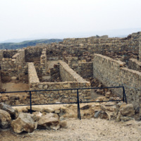
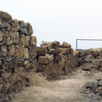
Excavations of Masada were not seriously undertaken until the 1960s when Masada became part of Israeli territory. With the help of twentieth century technology archeologists were able to access this natural fortress that had been largely untouched…

http://www.ricdigitalcommons.com/temp/1060.jpg
This photograph shows Masada’s natural fortification and ruins of King Herod’s Palace built in the first century BC. Because of it’s remote location and natural defenses, Masada has been mostly untouched since the first century BC. Recent…

http://www.ricdigitalcommons.com/temp/1069.jpg
Excavations of Masada were not seriously undertaken until the 1960s when Masada became part of Israeli territory. With the help of twentieth century technology archeologists were able to access this natural fortress that had been largely untouched…

http://www.ricdigitalcommons.com/temp/1064.jpg
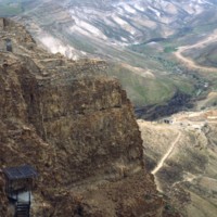
Upon embarking on a rigorous and dangerous climb, tourists can reach the top of Masada by a small number of pathways. Spanning around 200,000 square yards, the top of Masada is completely flat. Today, the top still contains the ruins of Herod’s…

http://www.ricdigitalcommons.com/temp/1066.jpg
Upon embarking on a rigorous and dangerous climb, tourists can reach the top of Masada by a small number of pathways. Spanning around 200,000 square yards, the top of Masada is completely flat. Today, the top still contains the ruins of Herod’s…

http://www.ricdigitalcommons.com/temp/1062.jpg
This photograph looks east from Masada towards the Dead Sea. Masada is a natural fortress that was most invested in by King Herod, who in the first century BC constructed a intricate palace atop this isolated horst. Masada was the site of a mass…

http://www.ricdigitalcommons.com/temp/4912.jpg
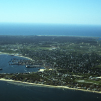
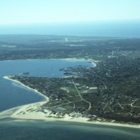
An aerial view of Nantucket Island and its harbor, in Massachusetts. Nantucket lies thirty miles south of Cape Cod, and is approximately fifteen miles in length. The town of Nantucket includes Nantucket Island as well as Tuckernuck Island, Muskegat…

http://www.ricdigitalcommons.com/temp/4913.jpg
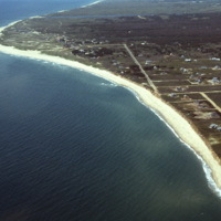
An aerial view of Nantucket Island and its harbor, in Massachusetts. Nantucket lies thirty miles south of Cape Cod, and is approximately fifteen miles in length. The town of Nantucket includes Nantucket Island as well as Tuckernuck Island, Muskegat…

http://www.ricdigitalcommons.com/temp/4914.jpg
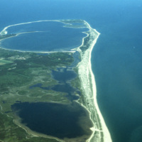
An aerial view of Nantucket Island in Massachusetts. Nantucket lies thirty miles south of Cape Cod, and is approximately fifteen miles in length. The town of Nantucket includes Nantucket Island as well as Tuckernuck Island, Muskegat Island, and a…

http://www.ricdigitalcommons.com/temp/4915.jpg
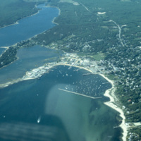
An aerial view of Nantucket Island and its harbor, in Massachusetts. Nantucket lies thirty miles south of Cape Cod, and is approximately fifteen miles in length. The town of Nantucket includes Nantucket Island as well as Tuckernuck Island, Muskegat…

http://www.ricdigitalcommons.com/temp/4917.jpg
An aerial view of Nantucket Island and its harbor, in Massachusetts. Nantucket lies thirty miles south of Cape Cod, and is approximately fifteen miles in length. The town of Nantucket includes Nantucket Island as well as Tuckernuck Island, Muskegat…

http://www.ricdigitalcommons.com/temp/4918.jpg
An aerial view of Nantucket Island and its harbor, in Massachusetts. Nantucket lies thirty miles south of Cape Cod, and is approximately fifteen miles in length. The town of Nantucket includes Nantucket Island as well as Tuckernuck Island, Muskegat…

http://www.ricdigitalcommons.com/temp/1071.jpg
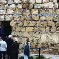
Largely untouched for two thousand years, this photograph shows the original Roman access road to Masada, which can still be traveled on foot by visitors. On the western side, this “ramp” was constructed by the Romans as a way to penetrate the…

http://www.ricdigitalcommons.com/temp/1068.jpg
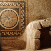
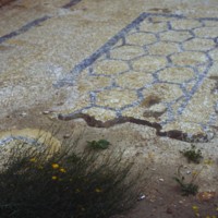
Mosaic in King Herod’s Palace at Masada. Despite it’s remote location, excavations at Masada have revealed beautiful tiles and mosaics, and balconies with beautiful views of the surrounding country. Masada was taken in A.D. 66 by Jewish rebels who…

http://www.ricdigitalcommons.com/temp/5239.jpg
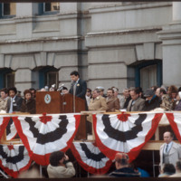
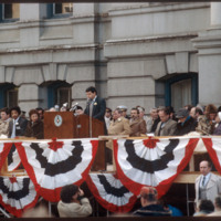
On January 3, 1983, Vincent A. “Buddy” Cianci was inaugurated as Providence’s mayor for his third term. Having held office for more than 21 years, Buddy is the longest serving mayor of Providence, including during the city's, “Renaissance phase.”…

5239.jpg
On January 3, 1983, Vincent A. “Buddy” Cianci was inaugurated as Providence’s mayor for his third term. Having held office for more than 21 years, Buddy is the longest serving mayor of Providence, including during the city's, “Renaissance phase.”…

http://www.ricdigitalcommons.com/Baxter_temp/CV-85-030.jpg
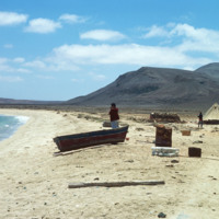
Cabral Beach has become one of Boa Vista's most popular beaches and tourist attractions. The beach is home to a hotel as well as a small Jewish cemetery. Additionally, Praia de Cabral has been the site of an annual music festival, which features Cape…

http://www.ricdigitalcommons.com/Baxter_temp/CV-85-056.jpg
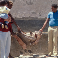
A man holding a child looks on as two other men display a large, unidentified dried fish.

http://www.ricdigitalcommons.com/Baxter_temp/CV-81-124.jpg
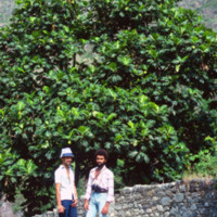
Two unidentified men on a road in the Ribiera do Paùl. They are pictured in front of a large tree and a stonewall. The same men are pictured in slide CV81135.

http://www.ricdigitalcommons.com/temp/0402.jpg
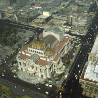
  The Palacio de Bellas Artes, the Palace of Fine Arts, in Mexico city was constructed in the early 1900s. President Porfirio Diaz wanted the building to commemorate Mexico’s independence from Spain. When a revolution broke out in 1910, construction…

http://www.ricdigitalcommons.com/temp/0533.jpg
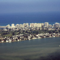
An aerial photograph of La Gorce island in Miami Beach, Florida. In the foreground is La Gorce Golf Course and Country Club. The eastern shore is lined with hotels and resorts.

http://www.ricdigitalcommons.com/temp/0541.jpg
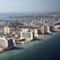
Looking north across Miami Beach’s Oceanfront show’s the hotels lined up on Collins Ave., the Bal Harbor Islands and Indian Creek, and finally North Miami on the horizon.

http://www.ricdigitalcommons.com/temp/0537.jpg
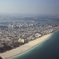
Looking south, this aerial photograph show’s Miami Beach’s Oceanfront in the late 1970’s. Clearly visible is the string of hotels in the style now known as Miami Modernist Architecture (MiMo) along Collins Ave. In the late 2000’s preservationists…

http://www.ricdigitalcommons.com/temp/0544.jpg
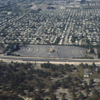
Residential neighborhoods and a drive in theater seen in this aerial photograph of Miami Beach. In the 1970s Miami Beach was largely a retirement community, but emigration from Cuba largely pushed them out in the following decade and effectively…
http://www.ricdigitalcommons.com/temp/0546.jpg
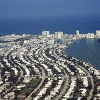
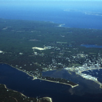
The Sunset Islands were the last of the man made islands to be built in Biscayne Bay. During the 1920s a land boom fueled the creation of several man made islands in Biscayne Bay, but at the end of a decade it the boom ended and many realtors went…
http://www.ricdigitalcommons.com/temp/0534.jpg
This aerial view shows Bal Harbor, Bal Harbor beach, and Biscayne Bay. At frame left, just above the small island, is where Florida International University’s Biscayne Bay Campus would be located. In this image some of the early construction for the…

http://www.ricdigitalcommons.com/temp/0536.jpg
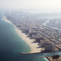
An east facing aerial photograph shows Miami Beach’s Oceanfront and Bal Harbor Islands in the late 1970’s. In the 1970’s Miami Beach’s tourism industry saw declines. Over the next decade, hundreds of Cuban refugee’s would move into the area which in…

http://www.ricdigitalcommons.com/temp/0535.jpg
This southeast facing photograph looks across Bal Harbor toward Miami Beach’s Oceanfront. Visible at the bottom of the frame is construction of Florida International University’s Biscayne Bay Campus.

http://www.ricdigitalcommons.com/temp/0573.jpg
Biscayne Point in Miami Beach is a residential neighborhood made up of three man made islands in Biscayne Bay. The Biscayne Point islands are a part of the North Beach, which is the are north of 63rd Ave and Collins. This aerial photograph looks down…

http://www.ricdigitalcommons.com/temp/0538.jpg
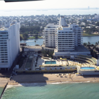
At the center of the aerial photograph is the Carillon Hotel, a wonderful example of the Miami Modernist Architectural (MiMo) style designed by Norman Giller. First opened in 1957, it has since been repurchased and modified. The current owners and…

http://www.ricdigitalcommons.com/temp/0543.jpg
The Eden Roc Renaissance Miami Beach was completed in 1956. Designed by architect Morris Lapidus after completing the Fontainebleu, the Eden Roc’s neighbor. Lapidus used curvy and innovative designs that were widely criticized at the time they were…

http://www.ricdigitalcommons.com/temp/0540.jpg
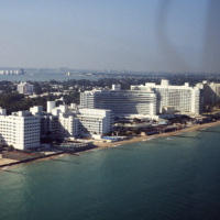
The Fontainebleau Hotel in Miami Beach is the one of the grandest hotels in the city and perhaps the epitome of Miami Modernist Architecture (MiMo). Designed by Morris Lapidus, it is considered the most significant building of his career. Just to the…
Output Formats

atom, dcmes-xml, json, omeka-xml, rss2