Dublin Core
Title
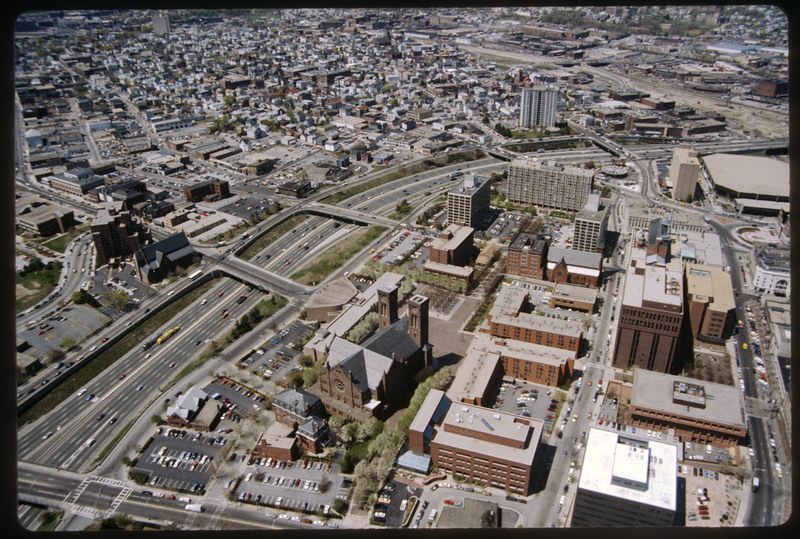
Weybosset Hill and Cathedral Square
Description
The Weybosset Hill area is bounded by Empire St. on the east, Broad and Washington Streets on the south and north, and Interstate 95 on the west. Redevelopment of this area stemmed from a 1959 recommendation of the City Plan Commission's master plan for Providence. Weybosset Hill cut off downtown from the West Side by blocking Westminster Street. Cathedral Square appears in the center of the photo.
Creator
Chester Smolski
Source
Woodward, PPS/AlAri Guide to Providence Architecture (Providence, 2003), 291-292.
Date
1987-01-01
Rights
Rhode Island College
Format
Photograph
Photograph
Identifier
5173
Smolski Image Item Type Metadata
City
Providence
Country
United States of America
Library of Congress Subject Headings
Aerial photography in land use -- Rhode Island -- Providence; United States Highway 95 (Rhode Island); Land use, Urban -- Rhode Island -- Providence; Weybosset Hill (Providence, R.I.); Urban renewal -- Rhode Island -- Providence Urban Development
Region
Rhode Island
Street Address
Weybosset Hill
Theme
Urban Development
