Dublin Core
Title
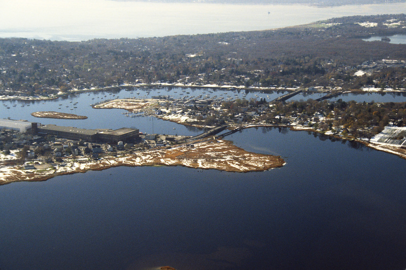
Warren/Barrington: Aerial Photograph
Description
This aerial photograph was taken over Warren and looks west across Barrington and to Narragansett Bay. This photograph shows the distinctive shoreline of Belcher Cover and Tyler Point. Barrington had been a part of Warren from the 1747 until 1770. Visible at the from left is one of the textile mills built in Warren in the late nineteenth century after the decline of the whaling industry.
Creator
Chester Smolski
Date
1990-01-01
Rights
Rhode Island College
Format
Photograph
Photograph
Identifier
0814
Smolski Image Item Type Metadata
City
Warren
Country
United States of America
Library of Congress Subject Headings
Cities and towns -- Rhode Island -- Warren; Cities and towns -- Rhode Island -- Barrington; Aerial photography – Rhode Island -- Warren; Aerial photography -- Rhode Island -- Barrington; Narragansett Bay (East Providence, R.I.);
Region
Rhode Island
