Dublin Core
Title
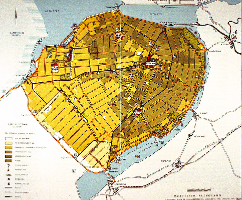
Eastern Flevoland Map
Description
This map of Eastern Flevoland is from the 1960s and may be used in reference to images from the Smolski collection photographed in 1960.
See Smolski Images: Irrigation of wheat Northeast Polder Netherlands; Netherlands: Sluice Gates on Enclosure Dam & IJsselmeer; Netherlands: Enclosure Dam & IJsselmeer;
Creator
Chester Smolski
Date
1969-10-01
Rights
Rhode Island College
Format
Photograph
Photograph
Identifier
1269
Smolski Image Item Type Metadata
Country
Netherlands
Library of Congress Subject Headings
Geography -- Maps;
Region
Flevoland
