Dublin Core
Title
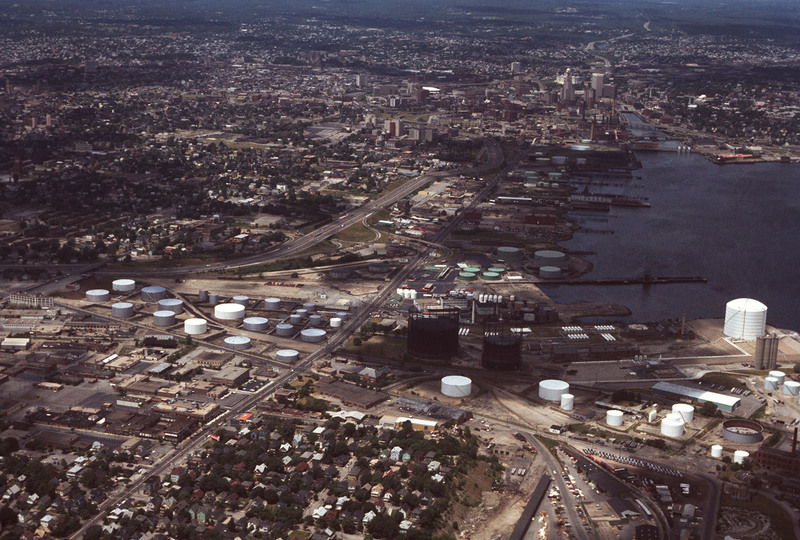
Providence Port
Description
Aerial view showing Providence Port circa 1976. Allens Ave. runs diagnolly across the picture plane, and Interstate 95 enters the frame on the right, curves around the city and continues north to the horizon. To the east (frame right) the Fox Point Hurricane Barrier, just a decade old at the time, is visible, parallel to the Point St Bridge and Interstate 195, which was later relocated in 2008 to just south of the Hurricane Barrier.
Creator
Chester Smolski
Date
1976-06-01
Rights
Rhode Island College
Format
Photograph
Photograph
Identifier
5384
Smolski Image Item Type Metadata
City
Providence
Country
United States of America
Library of Congress Subject Headings
Urban development-- Rhode Island-- Providence; Aerial photography in city planning-- Rhode Island-- Providence; City planning-- Rhode Island-- Providence; Land use, Urban-- Rhode Island-- Providence
Region
Rhode Island
