Dublin Core
Title
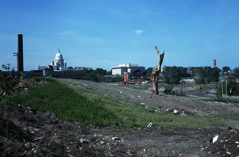
Randall Square - State House & Public Health Building
Description
General wasteland of Randall Square before renewal. St. Patrick’s Church can be seen in the left near the State House, and the Armenian Church is on the extreme right. Also of note are the triple-deckers to the west which were once part of continuous neighborhood in the Smith Hill area. These homes were left isolated by the incision of I-95 in 1958 which required the destruction of hundreds of homes, businesses, and two historic churches. Much of Randall Square was damaged by fire in 1971.
Creator
Chester Smolski
Date
1971-01-01
Rights
Rhode Island College
Format
Photograph
Photograph
Identifier
5165
Smolski Image Item Type Metadata
City
Providence
Country
United States of America
Library of Congress Subject Headings
Land use -- Vacant lands -- Rhode Island -- Providence; Cities and towns -- Growth -- Rhode Island -- Providence
Region
Rhode Island
Street Address
Charles St.
Theme
Wasteland
